Sometimes I spend Friday afternoons “gadgeting,” that is, researching software and gadgets that can help wrangle research, data, sources, and photos into something that resembles a website or dissertation. Today’s epiphany came courtesy of Picasa, free photo organizing software that is connected to a Google account. Research for both my dissertation and Documenting Cappadocia includes the five thousand photos I took in Turkey, images scanned and downloaded from a variety of haphazard sources, screenshots, and lots of sticky notes and photocopies. It’s kind of a mess.

While in Cappadocia I used iPhoto on a laptop to put my photos into albums and tag them by event, but was dissatisfied that I couldn’t visualize subfolders and found the library to be large and clunky. Aperture was organized the same way, offering more in the way of filters and Photoshop-type features–not what I needed at all. Picasa can detect folders from several places (like Dropbox or my desktop) and then photos can be organized into Picasa albums while they still live in folders elsewhere. (It’s worth a moment to read their “Folders versus Albums” page here). Photos can be tagged; metadata is visible in the properties panel; and subfolders can be visible as well. This is a good way to separate the photos that I took from images that have been scanned or downloaded for research only. I wish there were a way to add notes (and am experimenting with Evernote for smaller batches of photos).  Lyn offers a similar app for organizing photos, although it’s not free.

For my next trip, I will be more organized about collecting data. I just got a camera that records GPS coordinates and am testing out software and apps for recording data in the field. If you have suggestions, please leave a comment below.

 

When I began the Documenting Cappadocia project last year, I thought a WordPress site would be a quick and nifty way to share some lists and photos, hopefully inspiring more people to do research on Byzantine Cappadocia. While the original goal holds true, I’ve decided to adopt a more long-term strategy, building a database to serve the scholarly community, rather than just acting as social hub or album, and carefully considering the software and tools that are best suited for a project of this size.

My inspiration comes from the early explorers of Cappadocia who, in the early 20th century, documented Byzantine monuments by describing and photographing dozens of locations, often at great personal risk and expense. Volumes by Guillaume de Jerphanion, Marcell Restle, and Gertrude Bell (among others) are listed in the bibliography. These publications are still a valuable starting point for any scholar who researches Cappadocia, but the books are expensive, often out of print, and difficult to locate. Very few of these resources can be found online.

Another long tradition is that of the gazetteer, the directory or encyclopedic dictionary of places. Since antiquity, scholars have mapped important locations with a corresponding directory of information about each site. Twenty-first century gazetteers often build these resources online. Pleiades, for instance, began with the printed Barrington Atlas of the Greek and Roman World and now uses crowd-sourced information to link geographical and historical data about ancient places. You may have noticed Documenting Cappadocia’s list of Byzantine monuments. This will be the starting point for a database that contains an entry for each Byzantine site. The sites will then be incorporated into a searchable map, creating a gazetteer of Cappadocia, one that will digitize the early explorers’ tradition of documenting monuments into a twenty-first century tool for research.

After a brief hiatus, the Documenting Cappadocia blog is back. I’ll continue to post information about Cappadocia travel and research, as well as early explorers. But I’m also going to write about the process and tools that I’m using to build the site. Comments are always welcome, and I’d love to hear from scholars who are working on similar projects.

Last week I was introduced to Europeana, a giant repository of cultural heritage advocating Linked Open Data, at The Digital World of Art History conference held at Princeton’s Index of Christian Art. Europeana links data from many European cultural and scientific institutions, meaning that thousands of documents, photographs, and objects are searchable under one website.
Europeana’s entries are in various languages, and a search for “cappadoce” in this treasure trove turned up a video from Ina, a French audiovisual archive. Narrated in French, the 12-minute film, “Turquie: Voyage sans passeport” shows Byzantine rock-cut architecture, Greek mansions, close-up views of frescoes, and daily life in several villages during 1959. Follow the link to watch the film online, no passport necessary.

A screen shot from “Turquie: Voyage sans passeport.” Watch the film online: http://www.ina.fr/art-et-culture/beaux-arts/video/CPF86642685/turquie.fr.html#xtor=AL-3

2 Comments

Today marks the second annual Day of Archaeology, an online event dedicated to sharing the diverse activities of archaeologists throughout the world. Hundreds of archaeologists from around the world will share their own “day in the life” stories. These posts demonstrate the wide range of activities that archaeologists and their teams do to gather data and publish their findings. From digging in the dirt to building databases and from making coffee to organizing museum exhibitions, these tasks bring to light the myriad ways that basic archaeological information makes its way into public knowledge.

Ostensibly, ancient and medieval dwellings in Cappadocia would be excellent archaeological sites. But most complexes were made through cuting out of the rocky landscape, so there’s no real need to dig. Instead, archaeological surveys have been employed to great effect. For instance, Robert Ousterhout and his team surveyed the area near Çanlı Kilise, overturning the long-held belief that it had been a monastery. Veronica Kalas has published a survey of the settlement at Selime-Yaprakhisar, also arguing that secular settlements were a part of Byzantine society in Cappadocia. See the Documenting Cappadocia bibliography for a list of publications.

One of the more useful ways of viewing archaeology in terms of Cappadocia, then, its its inherent interdisciplinary nature. Archaeologists may be trained as art historians, anthropologists, historians, and IT practitioners. They are also quick to point out that there’s a difference between sharing data and producing scholarly work, and they are often involved in interpreting and disseminating their findings to both academic readers and the public at large. As I develop this site, archaeological projects continue to be an inspiration. At the Linked Ancient World Data Institute, archaeologists proved to be innovative participants in the Linked Data network, advancing digital publishing, and database building in ways that build foundations for further research. I hope that the data shared on this site will launch others into creating scholarly work as well.

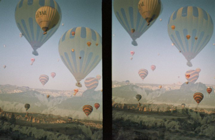
Balloons above Cappadocia at sunrise. (Photo taken as a double exposure with a Diana Mini analog camera).

Every good tourist knows that a hot-air balloon ride is a splendid way to view Cappadocia at a glance. In the video clip below, Professor Robert Ousterhout says during his first balloon ride that it feels as though he has “looked at Cappadocia from both sides now.” Certainly, the contrast between floating above the valleys and crawling inside the rock-cut architecture within the landscape is dramatic.

The video below is of Martha Stewart, accompanied by Professor Ousterhout, surveying the Rose Valley, a Byzantine settlement called Çavuşin, the volcanic cones of Paşabağ, and the geographic changes in the region that are visible from above. (Incidentally, I rode in a balloon with the same pilot last year). The clip aired on the Hallmark Channel in October 2010, and the link here is courtesy of Royal Balloon.


Martha Stewart & Royal Balloon – Cappadocia (The… by royalballoon

*Documenting Cappadocia does not endorse any particular balloon company. Hotels, guidebooks, and travel websites offer information for booking balloon rides. For instance, the Captivating Cappadocia blog has offered a series of posts on the topic.

1 Comment

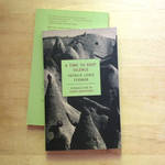
In a time of amateur archaeology and European Grand Tours, nineteenth- and early twentieth-century adventurers such as Father Guillaume de Jerphanion and Gertrude Bell felt a compulsion to explore and document Cappadocian monuments. Another celebrated travel writer and adventurer, Patrick Leigh Fermor, made a trip to Cappadocia much later, some time around 1950, I believe, but his description gives us an impression of how the rugged landscape and its Christian past were regarded by Western travelers after World War II. In A Time to Keep Silence, he calls the area “remote and dateless,” citing buffalo-carts and camels, and an extinct volcano [79]. Years after the trip, he recalled that the “ghostly monastic world of Cappadocia, too, remains as illuminating (and as irrelevant) as it appeared under the hot Anatolian sun,” [89].

His description of the settlements, at the time still thought to be exclusively monastic, comes at the end of a book in which he describes living and writing in European monasteries. In these places, he learned to thrive in their silence and peacefulness, away from the bustle of modern life. While his romanticized view of the cave dwellings ignores their enduring historical legacy and their importance to Byzantine studies, I have also written about the peacefulness that comes from overlooking ancient volcanic valleys through rock-cut rooms.

For Byzantinists, reading ancient or medieval Greek is inevitable. Here’s a list of resources for learning or refreshing Greek skills.

Do you have any tips for Greek reading and translations? Please share them in the comments below.

1 Comment

I am excited that Documenting Cappadocia and I have scored an invitation to the Linked Ancient World Data Institute (LAWDI) this weekend, hosted by New York University’s Institute for the Study of the Ancient World. Linked Open Data is a method of structuring digitally published information so that it is stable and easily linked, enabling more effective links and better-networked scholarly resources.

Initial reading assignments for the event reveal that data on the web are interrelated. Among discussions of programmers, academics, librarians, and other practicioners of Linked Open Data is how those relationships are best conveyed by stable identifiers. Tom Scott has considered the difference between using identifiers such as URIs to distinguish web documents from the real-world things those documents represent. Ed Summers responded with a call for common sense–of course people know the difference between a real-world object and a document about it on the web, but it’s possible to maintain that distinction. Mike Bergman has taken the debate into the philosophical realm, pondering the responsibilities and implications of the practice of naming, of developing a vocabulary in the real world or in terms of identifying data.

The debate within the Linked Data community revolves around relationships between things and documents. There’s an ontological element to this discussion–these objects seem to have a life of their own, making their way around the internet, holding on to metadata and links that people attach to the documents before sending them on their way. From a medieval art historian’s perspective, this is similar to thing theory, the study of the life and existence of objects that have an agency of their own. Relics and icons functioned this way in Byzantium, working miracles, for instance. Pilgrimage souvenirs were thought to actively protect the pilgrim. Gems could conquer thirst, or blue charms could ward off the evil eye, without necessarily needing to be activated by a person every time. Some of these objects were made by people, but all of them had an agency that continued separately from their creators.

So this is my theory: Linked Data has a life of its own. Although humans initially put the data out into the world, it can then demonstrate relationships between objects and documents, and it can convey information through metadata without further human intervention. As practicioners of Linked Data, it’s up to us to send that data out into the world with adequate links and thoughtful, stable identifiers.